







Comprehensive wayfinding system optimization for the Palace Museum. Scope covers perimeter approach, the Meridian Gate to Hall of Supreme Harmony axis, Eastern and Western Six Palaces, major and temporary exhibition halls, service amenities and cultural retail, accessible systems and emergency egress.
Project goal: create a replicable, maintainable, scalable wayfinding system for a world-class cultural institution and high-volume visitor environment that respects historic architecture and artifact preservation, orients first-time visitors within 30 seconds, enables route decisions within five steps in priority zones, and maintains order during peak flow.
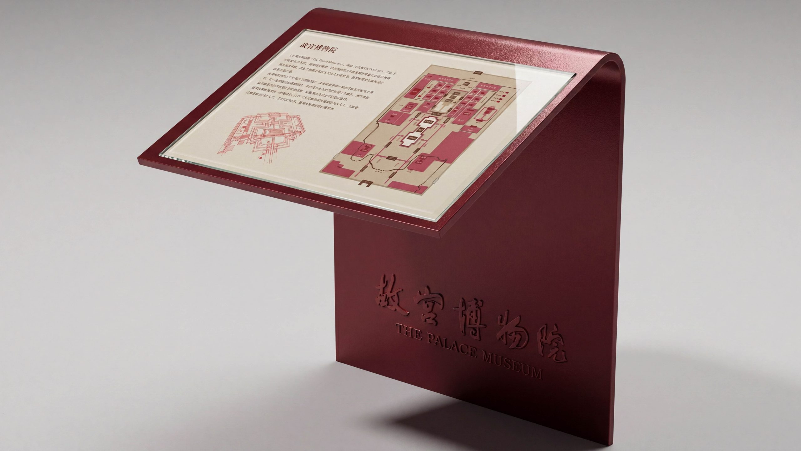
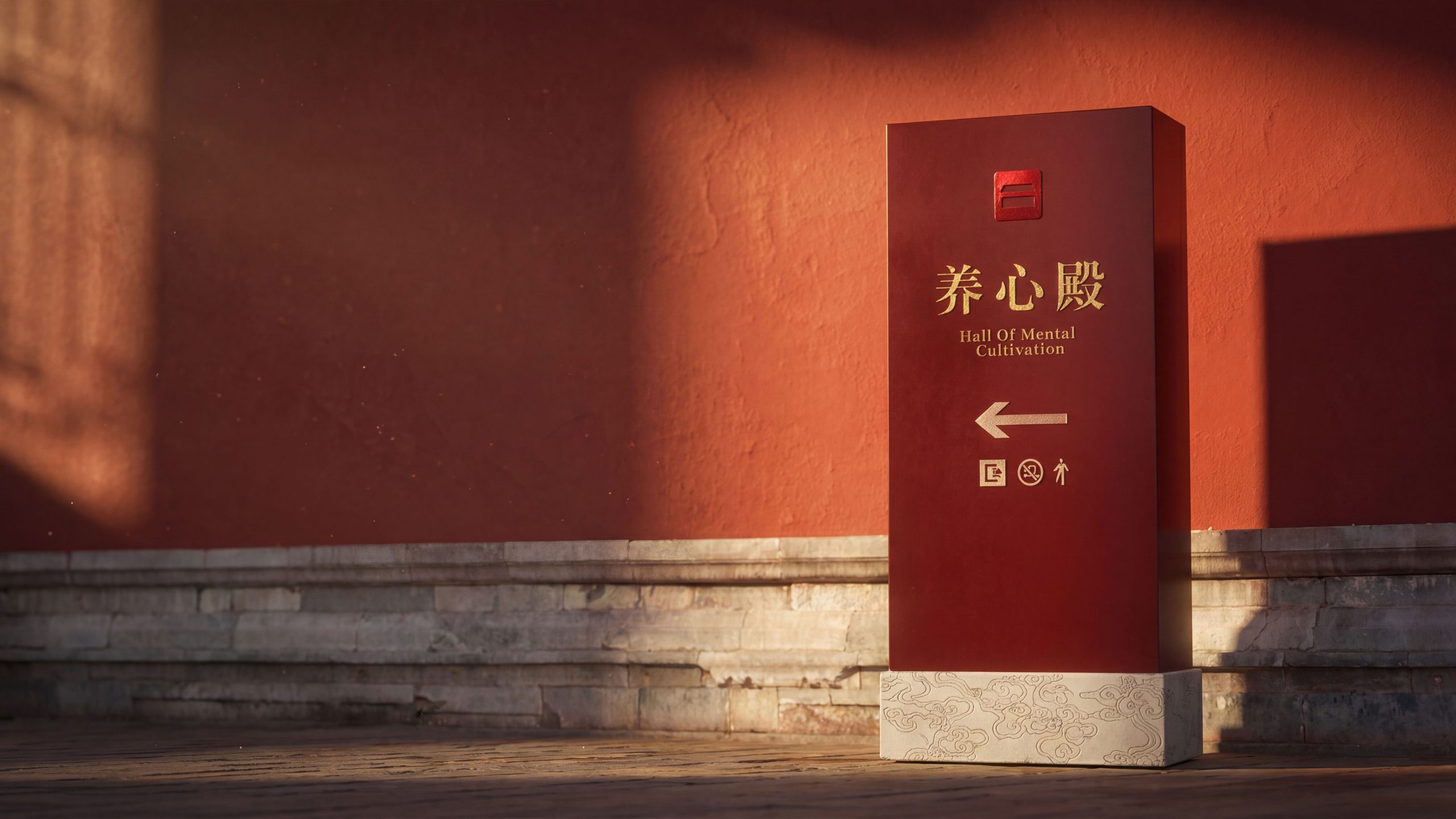
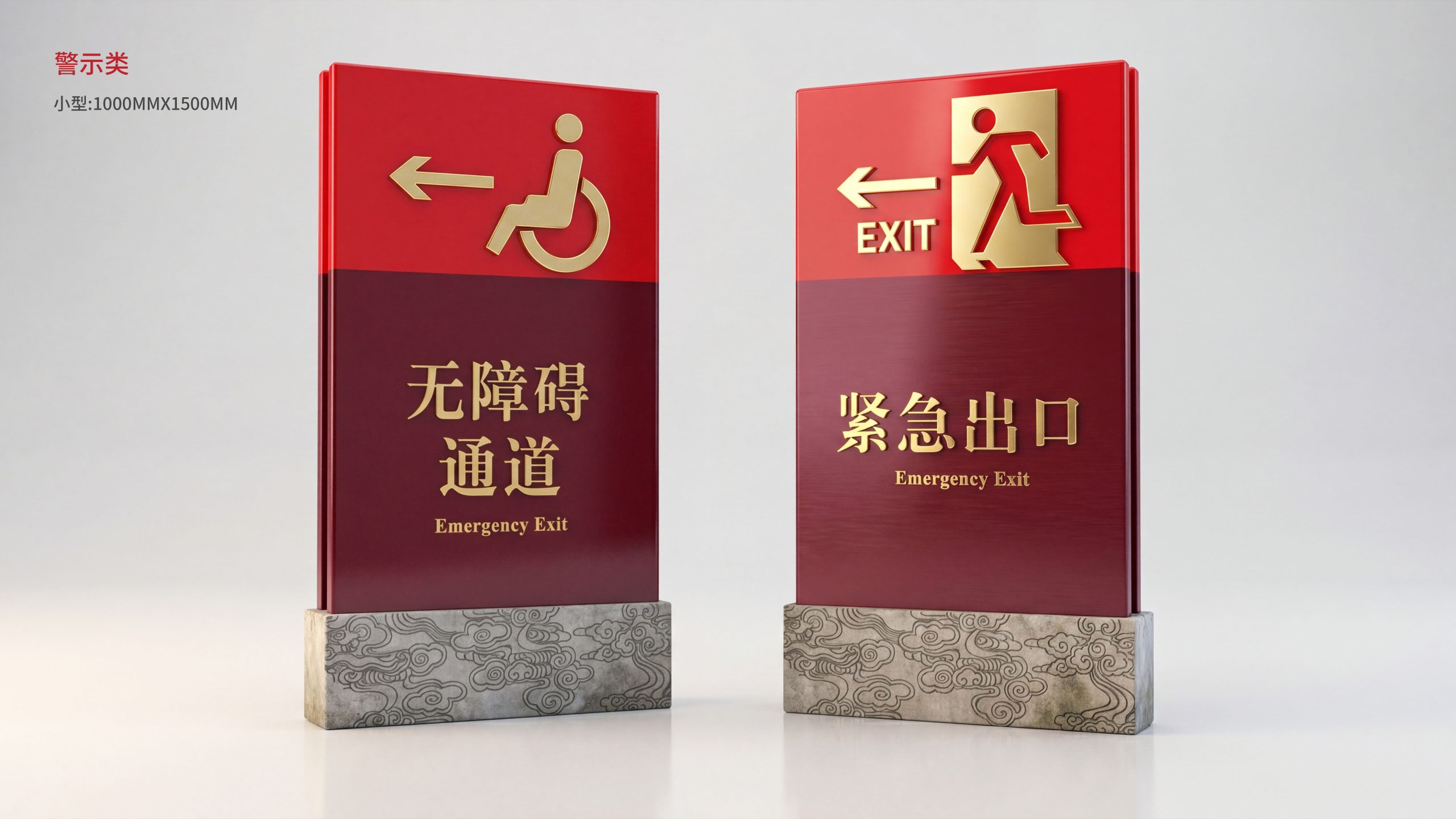
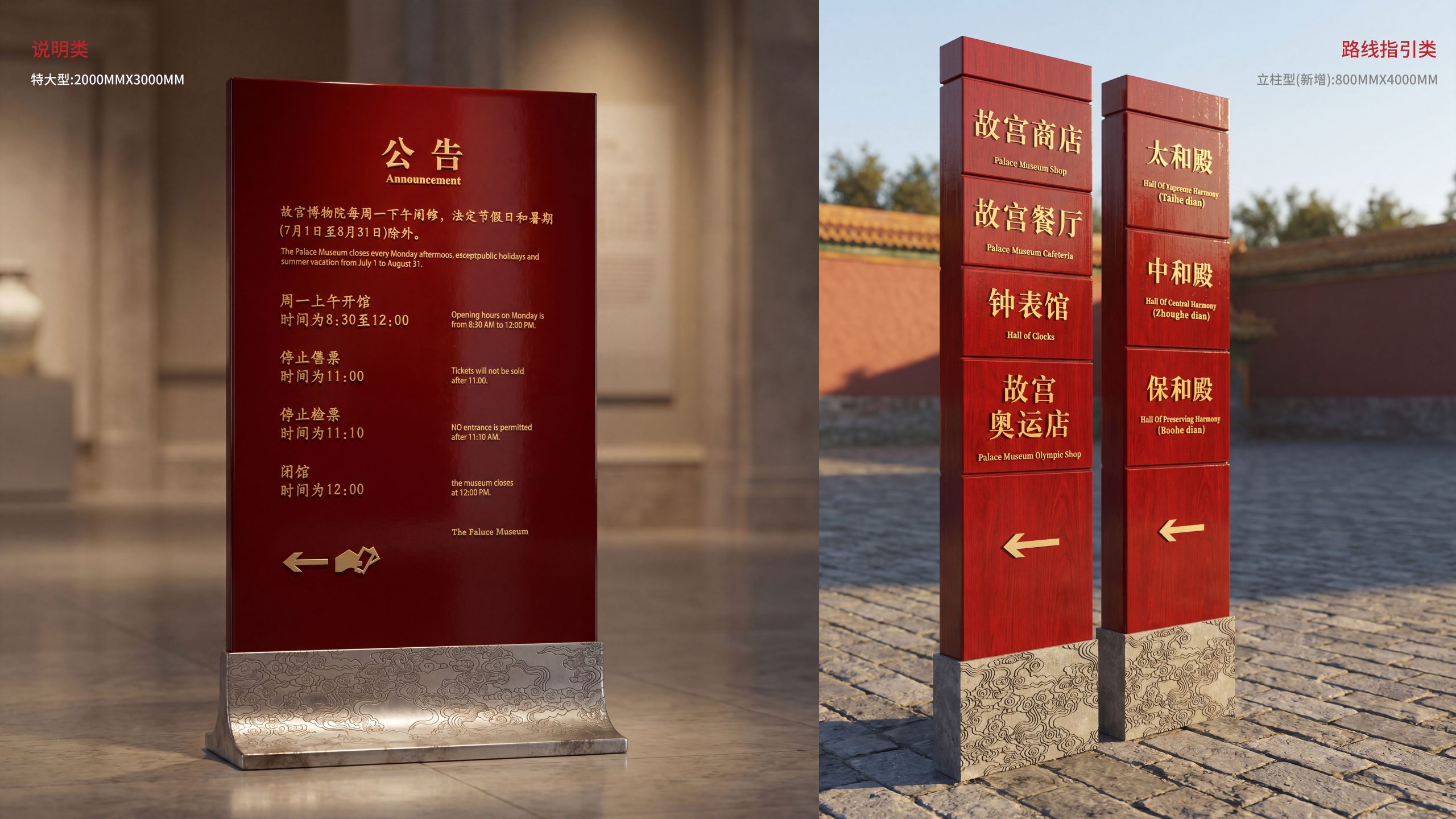
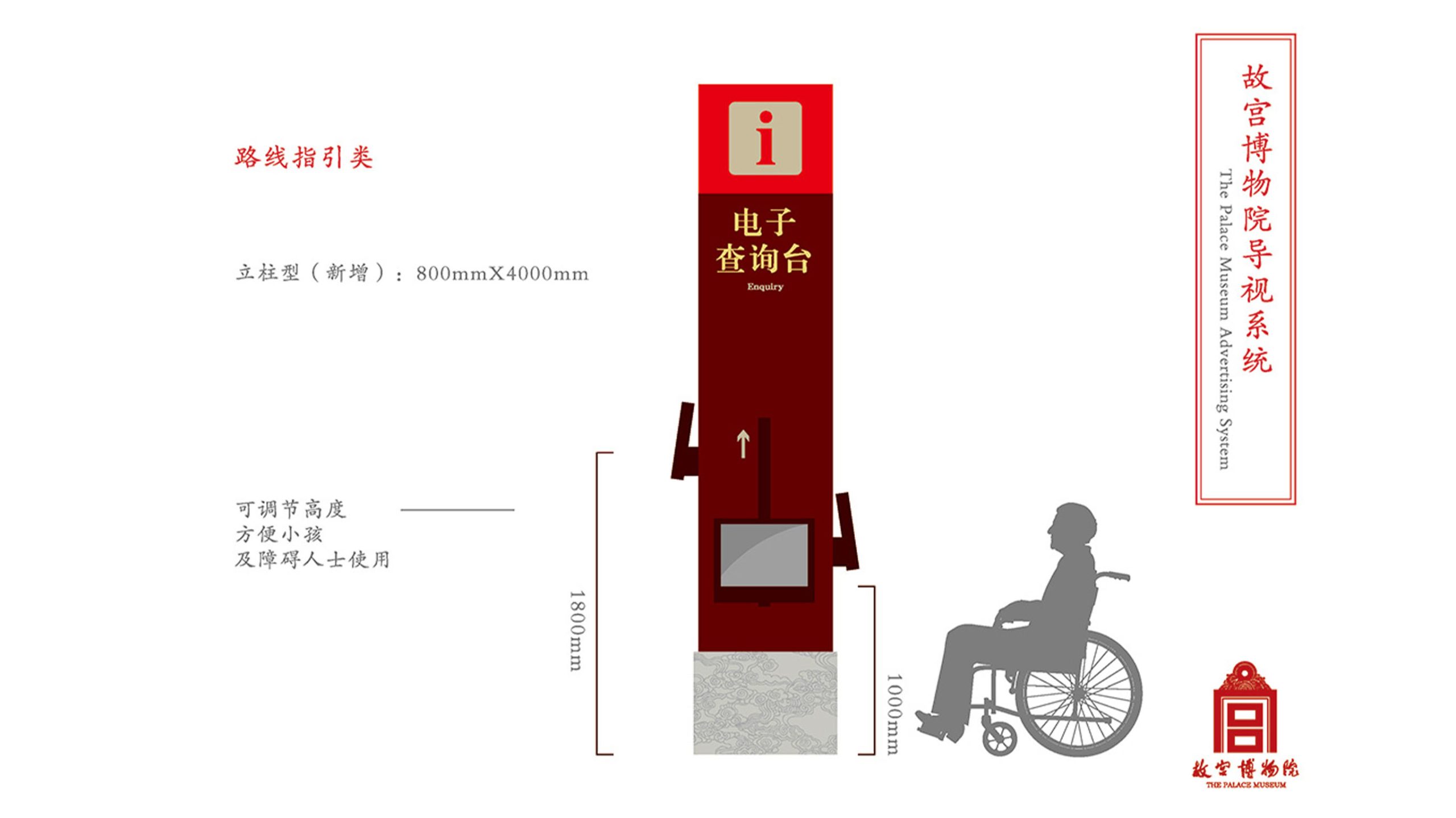
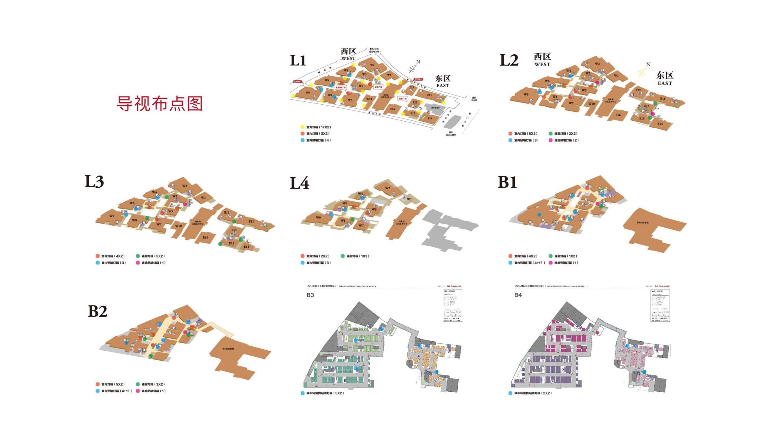
Assess the current state and define the goal
Based on site surveys and visitor heatmap analysis, problems identified include: uneven information density distribution; frequent temporary exhibition turnover causing localized information obsolescence; insufficient coupling of queue organization and circulation paths; scattered accessibility, child-friendly, and senior-friendly cues; inconsistent multilingual information hierarchy. Goals are structured in three categories: Directional continuity—three-tier wayfinding (central axis–corridor–courtyard) precisely linked, with secondary confirmation at all turns and long approaches. Reading stability—viewing distance, type size, contrast, illumination parameterized to perform across sunny/snowy/rainy/nighttime conditions and high-reflectance historic building materials. Operational efficiency—fixed/variable/temporary information templated for 5–10 minute swap-outs during exhibition changes and crowd control.
Methodology and Coding Strategy
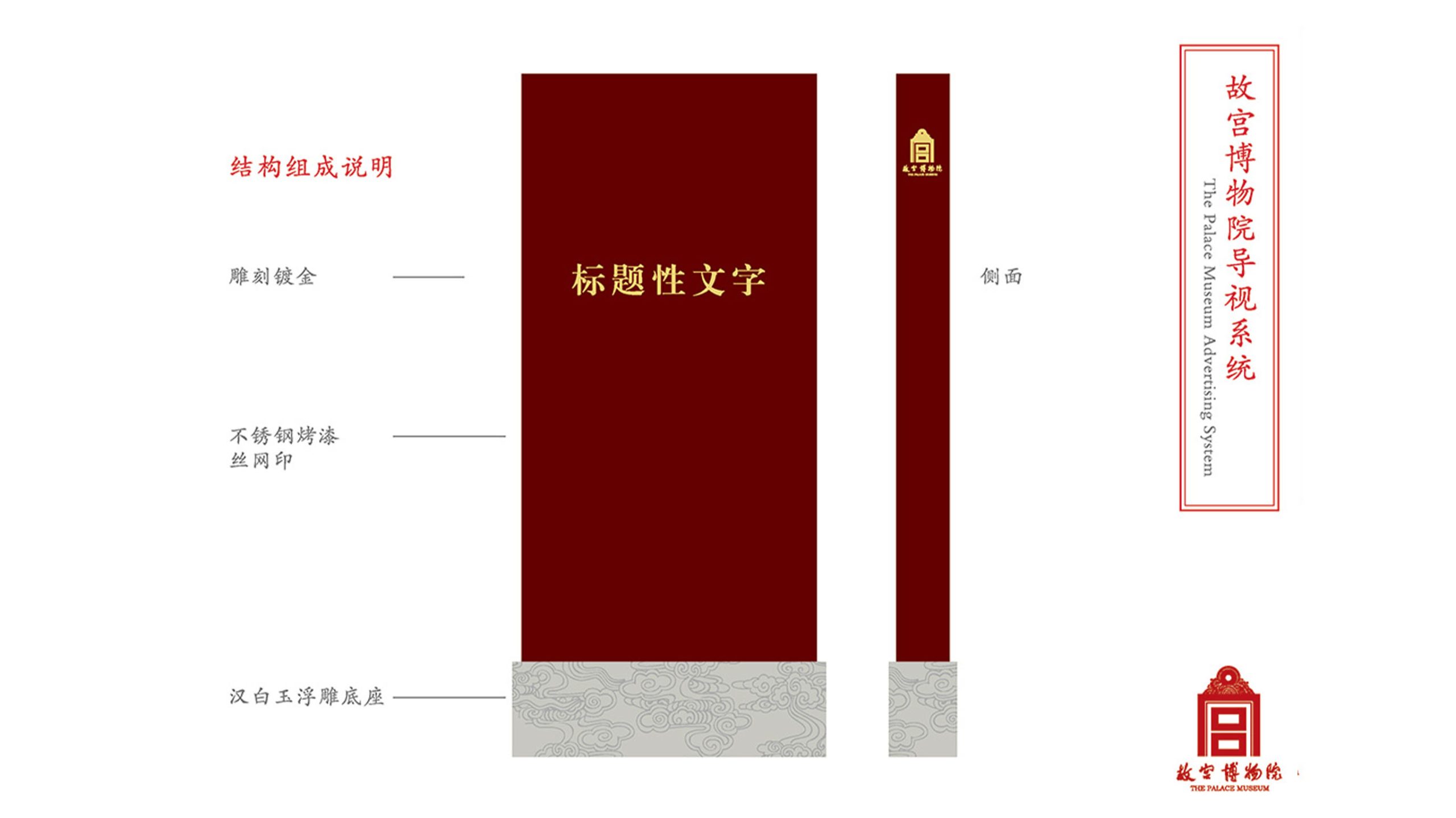
One grid: unified 8pt/4mm modular system governing signage and mounting hardware to ensure consistent appearance across courtyards; historic facades use non-invasive mounting and reuse existing anchors. Two viewing distances: far (30–80m) for axis nodes and plaza indexes; near (1–10m) for directional prompts, exhibition information, service cues; each with specified type size, contrast, minimum illumination thresholds. Three carrier types: fixed signage (gates, axis nodes, stairwells, service cores); variable information (exhibition updates, timed capacity limits, temporary closures); temporary guidance (peak queuing, one-way flow, construction detours, severe weather response). Four-level coding: campus–axis/ring–courtyard–entrance/gallery (alpha + numeric), integrated with ticketing, security, and flow monitoring systems to support timed reservations and phased organization. Five implementation phases: baseline survey–prototype testing (nighttime/rain/snow validation)–pilot calibration–full deployment–asset inventory and SOP handoff.
Visual and information rules
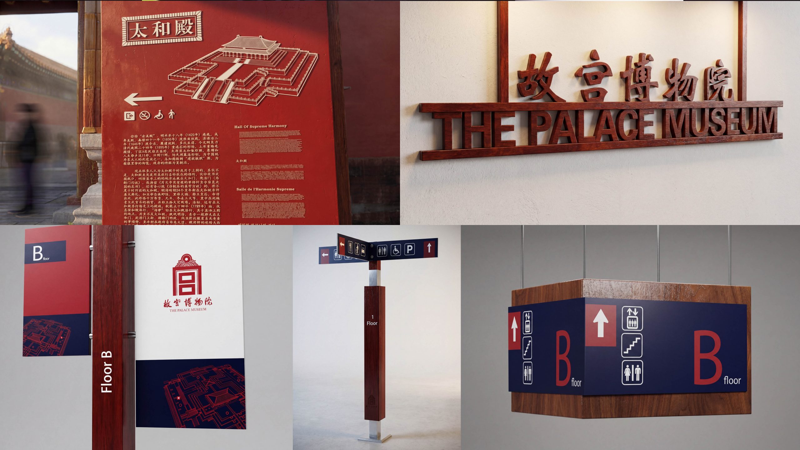
Color: 'slate blue / imperial red / limestone white' forms the environmental foundation; information layers use high-contrast black/white; functional emphasis employs restrained amber and safety yellow; artifact conservation and no-photography zones use dedicated color bands. Typography and languages: high-legibility sans-serif Chinese primary, English/Japanese/Korean secondary, pinyin where necessary; numerals and times in tabular figures for stable alignment. Type scale: far-distance primary identification ≥140mm; node zone signs 60–90mm; directional 30–40pt; rules and annotations 18–24pt; accessibility and safety information prioritized upward. Pictogram system: redrawn per ISO and accessibility standards, with custom icons for 'artifact protection / do not touch / no flash / queue entrance / flow exit / temporary exhibition'; arrows, numerals, and color bands share geometric rules. Layout: left-aligned, uniform column spacing, fixed leading; reading sequence 'where I am–where I'm going–how to get there–which gate/hall–notices,' avoiding backtracking. Optics: 4000–4300K neutral with glare control; panels in matte sandblast/microtexture laminate; reflection angle controlled toward historic facades, nighttime minimum illuminance and glare ceiling dual-threshold.
Applied in Context
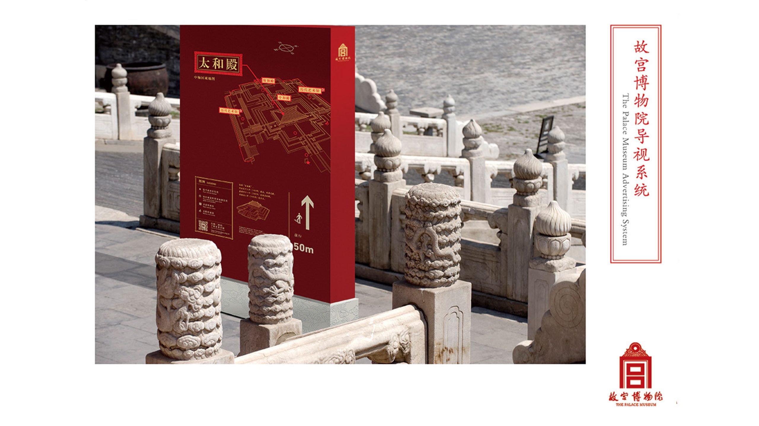
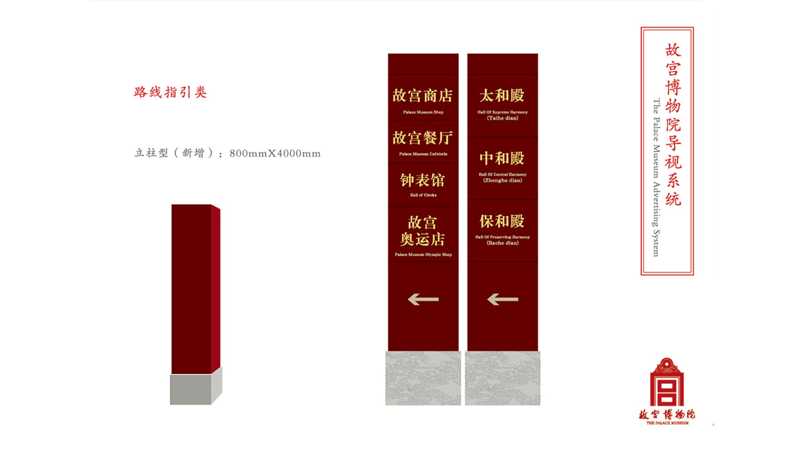
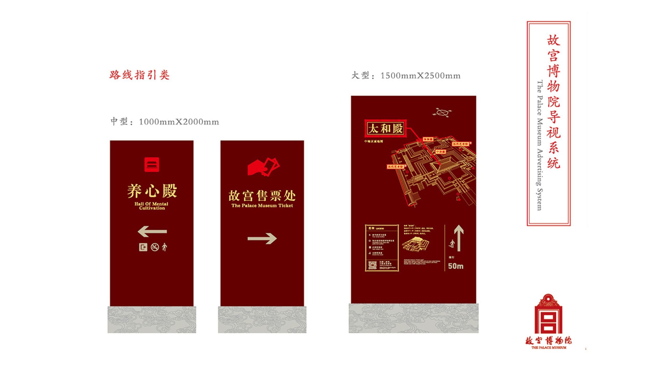
Perimeter and arrival: Meridian Gate, Gate of Divine Prowess, high signage and ground guidance integrated, clearly delineating reservation/on-site ticketing and security queue zones; severe weather activates 'temporary holding / turnaround' templates. Central axis nodes: Hall of Supreme Harmony–Central Harmony–Preserving Harmony employ two-part signage (node index + circulation suggestions), single-direction loop activated during peak periods; 'milestone confirmation markers' reduce backtracking. Eastern and Western Six Palaces and thematic exhibitions: courtyard entrances feature 'gallery list + circulation suggestions + traffic heat level' boards; gallery entrances show 'exhibition name–hours–capacity limit–no photography/quiet' four-line confirmation. Service systems: restrooms, water fountains, mother-baby rooms, accessible elevators, first aid points, cultural retail unified by icons; audio guide rental and app QR codes repeat at nodes. Accessibility and special populations: ramps/elevators/low-mounted signs paired with tactile guidance; child and senior-friendly cues on independent layer, rest point intervals and shade/rain shelter information annotated. Safety and emergency: evacuation maps, assembly points, emergency broadcast locations, weather event protocols, and congestion diversion templates standardized, one-click switchover for night/lantern festival events.
Delivery and operation and maintenance mechanism
Establish 'asset inventory + template library + data integration' closed loop. Each sign has unique code, installation coordinates, component and material list, cleaning and inspection log; interfaces with ticketing and flow platforms to dynamically push capacity limits and exhibition updates to digital boards. Handoff includes: wayfinding master plan and location drawings, layout and icon manual, historic-building-friendly installation protocols, hardware exploded views and bill of materials, optical and illumination parameters, emergency and severe weather templates, operations SOP and training materials. System achieves peak order control, information legibility, and long-term stable operations without compromising historic character or traditional ceremonial circulation.